


Geological Structure
The Priilmenskaya lowland, in the center of which the Polistovo-Lovatskaya bog system is located, is confined to preglacial depressions in bedrock and is located among the Devonian lowland. Under the Polistovo-Lovatsky massif (the western part of which is occupied by the Polistovsky Reserve), at the bottom of a former large post-glacial lake, there is bottom moraine almost everywhere.
The drowning of depressions, which began after the recession of the stagnant lake, initiated the formation of extensive bogs in the southern and middle parts of the Preilmenskaya Lowland, among which the Polistovo-Lovat array is one of the largest.
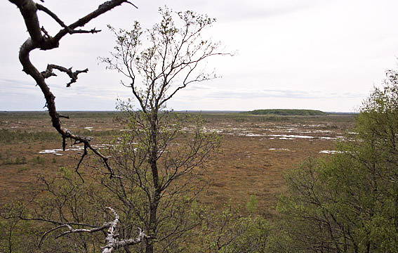
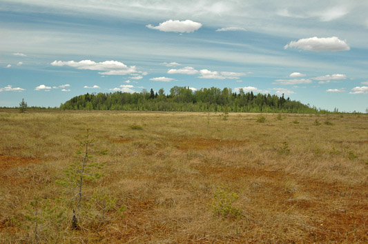
Within the Polistovo-Lovatskaya massif, the Prilmenskaya lowland consists of a group of separate depressions and elongated troughs, with elevated ridges and low plateaus between them. The overall slope to the north-northeast, weakly pronounced in the southern part of the peatland, is more significant in the northern part.
The Polistovo- Lovatskaya massif should be regarded as an interfluves bog located within one common depression, having one common slope, i.e., watershed-slope. The marsh massif is multi-peaked. These peaks were formed by the existence of several independent bogs. The peaks, located in the western and southern parts of the massif, are long and narrow and, therefore, quite consistent in their shape with the channel-like depressions in which they developed. The absolute surface elevations are between 98.0 and 100.67 m. The highest parts of the Polistovsky Marsh massif are located near the village of Veretje (99.87 m), between the villages of Zakhod and Medvezhye (99.7 m) and to the southeast of Lake Mezhitskoye (100.67 m). To the north of Mezhitskoye Rise, a dip corresponding to the same bottom slope is clearly pronounced. To the east, there is some slope. In the central hollow, there is no sharply pronounced convexity. In the northernmost part of the massif, the peat bog surface in the central ravine does not rise above the adjacent parts at all or it is even slightly lower. According to the physiographic zoning, the reserve is located in the Ilmen-Lovatsky district of flat, in some places swampy plains.
The soil cover of the Polistovsky Reserve is characterized by great complexity and diversity of soils by mechanical composition. Swampy-podzolic, peaty-gleyey and sod-podzolic soils prevail. Excessive moisture contributes to gleying of soils. The Polistovo-Lovatsky massif is characterized by a large peat thickness. Thus, in the area of the northern lakes of the Polistovsky Reserve and further north, its depth is 6-8.25 m. Under the top of the western trough, the thickness of the peat is at least 4 m, and often more than 5 m. In the most part of the massif, the upper part of the deposit is underlain by a 2-2.5 m thick layer of low-lying peat. In the western hollow, instead of low-lying peats, sapropel layer is up to 1.5-2 m and even up to 4 m thick. Under a considerable part of the massif, there is a thin layer of water sediments - sapropel and water peats (scorpidium, reed peat, etc.).